
Am considering an upgrade over the winter from my handheld Garmin GPSmap76cx handheld "poor man's chartplotter" with 1.5 X 2.25 inch screen (which I would keep handy as a backup). I have the 76cx loaded with Bluechart coastal charts, and mount it on the dashboard of our A25 with a RAM mount & wired to boat's 12V system. I am somewhat biased toward Garmins.
The latest GPSMAP 741xs chart plotter/depth sounder combo and the slightly less expensive comparable GPSMAP 820xs units seem like top choices. Both combine charting & depth sounder in one unit, with option to integrate with radar. The 741xs has touch screen technology with 7" screen. The 820xs had an 8" screen with buttons & up/down/sideways cursor rocker toggle but no touch screen functionality. Either unit would mean I'd be able to eliminate the current Garmin 240 fishfinder that resides at the starboard corner of the dashboard, although that would also require upgrading the thru hull transducer, which would substantially increase cost.
The 741xs also can wirelessly connect to a smartphone or tablet (via Bluetooth I assume). With the Garmin Bluechart marine app one can create waypoints, pre plan routes and more, then wirelessly transfer the information to plotter from smartphone or tablet. Sounds pretty slick. Price point difference between the two is $105. Is that extra expense worth it?
Would like to stay below $1K if possible.
Anyone have any experience with either of these units, or recommendations for other types?
• Welcome to https://albinowners.net, the new home of Albin Owners Group!
• You will need to log in here, and you may want to bookmark this site. If you don't remember your password, use the I forgot my password link to reset it.
• All content has been transferred from our previous site. Digests will be enabled soon.
• Contact Us if you have any questions or notice a problem. If you're not receiving our email, include a phone number where we can text you.
FAQ:
• Membership information
• Burgees
• How to post photos
• Membership information
• Burgees
• How to post photos
Chartplotter recommendations?
-
DesertAlbin736
- Gold Member

- Posts: 2729
- Joined: Sun Mar 09, 2014 3:58 pm
- Home Port: Peoria, AZ USA
Chartplotter recommendations?
La Dolce Vita
1971 Albin 25 #736
Yanmar 3GM30F
Gig Harbor Boatworks Nisqually 8 dinghy
Residence: Peoria, AZ
Homeport: Lake Pleasant, AZ & beyond
1971 Albin 25 #736
Yanmar 3GM30F
Gig Harbor Boatworks Nisqually 8 dinghy
Residence: Peoria, AZ
Homeport: Lake Pleasant, AZ & beyond
-
Ben423
- Gold Member
- Posts: 188
- Joined: Tue Feb 10, 2015 9:31 am
- Home Port: Two Harbors
- Location: Southern California
- Contact:
Re: Chartplotter recommendations?
When I bought my 28 it had a near new Raymarine chartplotter/radar/fishfinder. It's a nice enough unit but the chart display is not easy to read and it has many functions I don't need. Further, if it's in fishfinder or radar mode, the chart screen is tiny. Lastly, I'm not a fan of Raymarine documentation or product support. So I installed a Garmin 74 (7" screen) in the dash next to the Raymarine display. I much prefer having a dedicated chartplotter that's on all the time. Also, based on experience on other boats, I chose the non-touch screen because when we're moving in a seaway, it can be frustrating putting my finger exactly where I want it with the boat bouncing around. The Garmin also integrates AIS info and provides me with a simple, stand-alone unit. Of course I still have the Raymarine chartplotter display as a backup.
-
Sprig1
- Gold Member
- Posts: 390
- Joined: Thu Dec 11, 2014 5:05 am
- Home Port: Long Cove Marina, Chester River Maryland
Re: Chartplotter recommendations?
I know this the cheap way out. Have you ever tried Seaiq on a iPad for $25.00. It works great but is not nearly as impressive looking. I would love to have the one your looking at. But the boat bucks always seem to go some place else.
-
Jay Knoll
- Gold Member
- Posts: 475
- Joined: Wed Aug 04, 2010 11:21 am
- Home Port: Vero Beach FL
Re: Chartplotter recommendations?
I have the 741xs and have been very happy with it, I needed a depth finder and the Seaiq/ipad didn't have that option. I was burned a couple of years ago when I upgraded my ipad and discovered that it no longer worked with the external gps, fortunately we hadn't upgraded my wife's ipad so we used that for our trip but I vowed that I would only use dedicated navigational hardware in the future.
-
Norseman
- Gold Member
- Posts: 1695
- Joined: Mon Jul 13, 2015 10:58 am
- Home Port: Palm Coast, Florida
- Location: Marina del Palma
- Contact:
Re: Chartplotter recommendations?
I installed Garmin 1040XS on top of the dash recently.
Good unit and the sell for half price these days, less than a grand.
Only drawback is that it hides the compass, will have to move it one day.
Good unit and the sell for half price these days, less than a grand.
Only drawback is that it hides the compass, will have to move it one day.
2001 28TE, 6LP-STE, 1,337 hrs, 19X18 four-blade wheel.
-
DesertAlbin736
- Gold Member
- Posts: 2729
- Joined: Sun Mar 09, 2014 3:58 pm
- Home Port: Peoria, AZ USA
Re: Chartplotter recommendations?
I'm kind of with you Jay, leaning toward the 741xs. I called the tech line at thegpsstore.com and they assured me that the conventional thru-hull transducer I have for my existing Garmin Fishfinder 240 will work with the 741xs, using a 6 pin to 8 pin cable adapter and lacking only the finer functions of CHIRP and DownVU technology, which I really don't need since I'm not a serious fisherman. The less expensive 820xs with conventional button controls has most of the same features as the 741xs, but lacks wireless connectivity to smart phones & tablets. Integrating chartplotter with depth sounder will free up some space at the helm station where I can mount the chartplotter next to the VHF. Not sure if I'll bother adding Sirius XM weather overlays. The Sirius XM receiver/antenna is another $660 plus subscription, but our cruising plans for next year include the Strait of Georgia in British Columbia where the weather is like a box of chocolates, you never know what you're going to get. Dead calm one day and blowing like stink the next, so real time weather data including forecasts, with isobars, satellite and precipitation radar overlays could be very valuable. The Canadian weather service radio forecasts are pretty sketchy.
Garmin GPSMAP 741xs demo video
https://www.youtube.com/watch?time_cont ... hL75_BmI3s
Another thing on my 2018 uprade list is to replace my ancient barebones Uniden piece of s**t VHF that I inherited from previous owner with a Standard Horizon GX2200 Matrix with built in AIS reciver & GPS. The existing Uniden doesn't even get weather channels, let alone DSC capability.
https://www.thegpsstore.com/Standard-Ho ... P3968.aspx
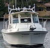
Existing GPS & Fishfinder. The rolled up black mesh screen material behind them is used to screen in the wheelhouse hard top hatch openings for shade & keeping bugs out. A new VHF could go where the GPS is in this picture and the chart plotter could go where the existing fishfinder is.
Garmin GPSMAP 741xs demo video
https://www.youtube.com/watch?time_cont ... hL75_BmI3s
Another thing on my 2018 uprade list is to replace my ancient barebones Uniden piece of s**t VHF that I inherited from previous owner with a Standard Horizon GX2200 Matrix with built in AIS reciver & GPS. The existing Uniden doesn't even get weather channels, let alone DSC capability.
https://www.thegpsstore.com/Standard-Ho ... P3968.aspx
Existing GPS & Fishfinder. The rolled up black mesh screen material behind them is used to screen in the wheelhouse hard top hatch openings for shade & keeping bugs out. A new VHF could go where the GPS is in this picture and the chart plotter could go where the existing fishfinder is.
You do not have the required permissions to view the files attached to this post. To view images, please register for a free account.
La Dolce Vita
1971 Albin 25 #736
Yanmar 3GM30F
Gig Harbor Boatworks Nisqually 8 dinghy
Residence: Peoria, AZ
Homeport: Lake Pleasant, AZ & beyond
1971 Albin 25 #736
Yanmar 3GM30F
Gig Harbor Boatworks Nisqually 8 dinghy
Residence: Peoria, AZ
Homeport: Lake Pleasant, AZ & beyond
-
Sunsetrider

- Gold Member
- Posts: 488
- Joined: Fri Jun 28, 2013 6:49 am
- Home Port: Gananoque ON
- Location: Sharbot Lake Ontario Canada
- Contact:
Re: Chartplotter recommendations?
I am going through a similar set of considerations. I am generally satisfied with using the ipad for navigation, loaded with a variety of nav apps, primarily Navionics, with Garmin Blue Charts for AC info. My old Humminbird depth sounder does what I need it to do. But everywhere I ask for advice on prepping to set out on a voyage, folks recommend a chart plotter. Other than better daylight visibility, is there any advantage to going with a dedicated plotter over the ipad? Weather protection is not an issue in the pilot house.
If it makes sense to upgrade, I would consider the 741xs that DA is looking at, looks to be more functional than the Raymarine Dragonfly 5 I was also looking at.
If it makes sense to upgrade, I would consider the 741xs that DA is looking at, looks to be more functional than the Raymarine Dragonfly 5 I was also looking at.
1976 Albin 25 Hull 2529
-
DesertAlbin736
- Gold Member
- Posts: 2729
- Joined: Sun Mar 09, 2014 3:58 pm
- Home Port: Peoria, AZ USA
Re: Chartplotter recommendations?
Chartplotters are waterproof, bolted down & run off the boat's 12V system. Newer ones like the 741xs combine chartplotter with depth sounder, and even radar all in one screen, so you can remove the existing fishfinder and de-clutter the helm station. Plus wireless connectivity to iPad, iPhone, and Android smart phones and tablets. I would guess but am not sure that they can also be unplugged and taken ashore to prevent theft.
In our case, I could leave the existing Garmin Fishfinder 240 in place so as to have two screens. The 240 fishfinder is a black & white screen vs color. I'd have to either not have the depth sounder function on the 741xs, or add a 2nd transponder (not a bad idea from the Department of Redundancy Department, but expensive), or if possible a cable splitter to allow both to get signals from one transponder. Desertboater over on the A25/A27 page made a passing reference to the "Ms Bettancourt's Next Voyage" blog which has an entry dated November 8, 2014 on what they did with chartplotter and fishfinder. In his case he had a then-new Garmin GPSmap 546s and old Humminbird fishfinder. The GPSmap 546s combo chartplotter, was an upgrade from an older GPSmap 192c chartplotter. The Humminbird was getting flakey, so he yanked that. He could have gone with just one screen with the 546s, but re-installed the old 192c as a backup chartplotter, so he could display the depthsounder full screen on the 546s while using the 192c for map display.
http://msbettencourtsnewtop.blogspot.com/
Here is his setup:
"Ms Bettancourt's" old configuration with Hummingbird depth sounder center and new 546s chartplotter at right.
New (as of 2014) configuration with Hummingbird sounder replaced by old GPSmap 192c
Now those older chartplotters have smaller screens than the new 741xs, so having two screens may not be necessary. I'll have to decide on that when I get one.
I can't tell from the picture what brand his VHF is, but I'd probably mount mine & the compass like that. Right now my old VHF is mounted vertically below the starboard side window. My choice, since I relocated it from where it was up on top of the dash where the previous owners had it. I guess the 741xs only comes in black, but I'd want white for the VHF, which would match the bracket mount compass that I already have, which other than color is the same as Ms Bettancourt's.
You do not have the required permissions to view the files attached to this post. To view images, please register for a free account.
La Dolce Vita
1971 Albin 25 #736
Yanmar 3GM30F
Gig Harbor Boatworks Nisqually 8 dinghy
Residence: Peoria, AZ
Homeport: Lake Pleasant, AZ & beyond
1971 Albin 25 #736
Yanmar 3GM30F
Gig Harbor Boatworks Nisqually 8 dinghy
Residence: Peoria, AZ
Homeport: Lake Pleasant, AZ & beyond
-
Sunsetrider
- Gold Member
- Posts: 488
- Joined: Fri Jun 28, 2013 6:49 am
- Home Port: Gananoque ON
- Location: Sharbot Lake Ontario Canada
- Contact:
Re: Chartplotter recommendations?
Have you given thought to incorporating an AIS capability? If you are looking at a new VHF, the Standard Horizon GX2200 is worth a look.
1976 Albin 25 Hull 2529
-
DesertAlbin736
- Gold Member
- Posts: 2729
- Joined: Sun Mar 09, 2014 3:58 pm
- Home Port: Peoria, AZ USA
Re: Chartplotter recommendations?
Yes, absolutely. I mentioned that in an earlier post on this thread (with photo attached). Very much so on my list. Last time we were up in Strait of Georgia in BC there was lots of barge-tug and ferry traffic to watch out for.Have you given thought to incorporating an AIS capability? If you are looking at a new VHF, the Standard Horizon GX2200 is worth a look.
You do not have the required permissions to view the files attached to this post. To view images, please register for a free account.
La Dolce Vita
1971 Albin 25 #736
Yanmar 3GM30F
Gig Harbor Boatworks Nisqually 8 dinghy
Residence: Peoria, AZ
Homeport: Lake Pleasant, AZ & beyond
1971 Albin 25 #736
Yanmar 3GM30F
Gig Harbor Boatworks Nisqually 8 dinghy
Residence: Peoria, AZ
Homeport: Lake Pleasant, AZ & beyond
-
Sunsetrider
- Gold Member
- Posts: 488
- Joined: Fri Jun 28, 2013 6:49 am
- Home Port: Gananoque ON
- Location: Sharbot Lake Ontario Canada
- Contact:
Re: Chartplotter recommendations?
Too much internet forum reading to remember Everything! 
1976 Albin 25 Hull 2529
-
Nepidae

- Gold Member
- Posts: 142
- Joined: Mon Jun 11, 2012 7:33 am
- Home Port: Essington, PA
- Location: On the Loop
Re: Chartplotter recommendations?
While I understand a desire to stay on the inexpensive side, I think you also need to look long term and the possibilities that could occur. Are you or do you think that you could be interested in an autopilot, AIS, you mentioned radar, would you want that superimposed on the chart?
Taking these things into consideration NOW is important.
I am a Garmin fan myself and can't wait to see what their purchase of Active Captain & Navionics will produce plus the inclusion of inReach that used to be owned by DeLorme.
Last season we put on our boat a 7612xsv (which replaced a 740S) chartplotter. We also added radar (Fantom24), smartpump Autopilot and 600 AIS. I replaced a new 24xHD which I have for sale with some warranty left.
I am a cruiser but it would be nice for anyone to have the ability to sit on the flybridge (pick your steering station) and let the boat do the driving. The AIS has helped on numerous occasions.
Certainly, we spent more than $1,000 but we also got more.
If you'd like to discuss specifics, drop me an email.
Calm seas,
Charles
Jane & Charles Williamson
m/v Nepidae
Albin 43 Sundeck
Nepidae.trawler@gmail.com
MTOA-3927
AGLCA - 12114 (ret)
Currently: On the Loop
Charles
Jane & Charles Williamson
m/v Nepidae
Albin 43 Sundeck
Nepidae.trawler@gmail.com
MTOA-3927
AGLCA - 12114 (ret)
Currently: On the Loop
-
DesertAlbin736
- Gold Member
- Posts: 2729
- Joined: Sun Mar 09, 2014 3:58 pm
- Home Port: Peoria, AZ USA
Re: Chartplotter recommendations?
We inherited an Autohelm tiller pilot that came with the boat & has a wired remote used to control from the helm station. But it's a PITA to set up. One has to attach an emergency stub tiller handle under the center floor of the aft cabin, then attach the tiller pilot unit. The few times we tried to try it out it did not hold course well. Wheel autopilots are too expensive to bother with, and manual steering has not been a problem so far.
As far as the 7612xsv vs the 741xs, the 7612xsv goes way beyond my budget to add an extra 5 inches of screen size. We don't rely solely on the GPS chartplotter display, but also use paper charts for an overview reference. One of the nice features of the Albin 25 is that the dash layout has a chart table surface built in at the helm that can accommodate folded charts and 16 X 24 chart atlases . The 741xs appears able to do all the things we need, including wireless connectivity with smart phones and tablets, plus the option to add radar, especially combined with the Standard Horizon GX2200 VHF with built in GPS and AIS receiver.
We been to a lot of places with our boat, San Juans, Gulf Islands, Sunshine Coast in Pacific NW, Catalina Island in SoCal, plus Erie Canal, Seneca & Cayuga Lakes, Block Island Sound, Chesapeake Bay on the East coast, but so far have no plans to attempt the loop. We don't particularly like muggy and buggy, and my wife gets welts if she even sees a mosquito.
If you're home port is Cayuga, NY, then this scene may be familiar, the launch ramp at Seneca Lake State Park.
Lock CS4 between Seneca and Cayuga Lakes
You do not have the required permissions to view the files attached to this post. To view images, please register for a free account.
La Dolce Vita
1971 Albin 25 #736
Yanmar 3GM30F
Gig Harbor Boatworks Nisqually 8 dinghy
Residence: Peoria, AZ
Homeport: Lake Pleasant, AZ & beyond
1971 Albin 25 #736
Yanmar 3GM30F
Gig Harbor Boatworks Nisqually 8 dinghy
Residence: Peoria, AZ
Homeport: Lake Pleasant, AZ & beyond
-
WillieC
- Gold Member
- Posts: 2268
- Joined: Wed Nov 13, 2013 10:48 am
- Home Port: Hood Canal, WA
Re: Chartplotter recommendations?
FWIW we us a free AIS program on our cell phone. Not ideal but works for us in the Puget Sound.
On a bit of a side note, we also use SeaClearII with a gps dongle on one of our old laptops. Still getting used to it, having never messed much with all the details even of our Garmin mini plotter. One bug-a-boo with SeaClear is that it automagically swaps charts as you cross the edge of the page. I like to look farther into the future than that, even though six knots may not warrant that. And it did some weird things as we got into the Tacoma Narrows, flipping to a portion of a chart with hardly any info on it. I thought I had downloaded all the charts for the state of Washington, but I may need to review to make sure. Also, SeaClear in their chart list, gives not quite the same chart name as the real chart, and they don't list them by the Official Chart Number, at least I have not discovered that feature if it exists. (Sorry to digress, maybe this needs another thread, if there is enough interest and if anybody is still using that ancient program.)
On a bit of a side note, we also use SeaClearII with a gps dongle on one of our old laptops. Still getting used to it, having never messed much with all the details even of our Garmin mini plotter. One bug-a-boo with SeaClear is that it automagically swaps charts as you cross the edge of the page. I like to look farther into the future than that, even though six knots may not warrant that. And it did some weird things as we got into the Tacoma Narrows, flipping to a portion of a chart with hardly any info on it. I thought I had downloaded all the charts for the state of Washington, but I may need to review to make sure. Also, SeaClear in their chart list, gives not quite the same chart name as the real chart, and they don't list them by the Official Chart Number, at least I have not discovered that feature if it exists. (Sorry to digress, maybe this needs another thread, if there is enough interest and if anybody is still using that ancient program.)
-
Sunsetrider
- Gold Member
- Posts: 488
- Joined: Fri Jun 28, 2013 6:49 am
- Home Port: Gananoque ON
- Location: Sharbot Lake Ontario Canada
- Contact:
Re: Chartplotter recommendations?
WillieC - I've been looking for a low-level AIS for phone or ipad but can't seem to find it. Can you suggest what I might look for?
1976 Albin 25 Hull 2529